Transasia AT72 at Makung on Jul 23rd 2014, impacted buildings on approach
A Transasia Avions de Transport Regional ATR-72-212A (500), registration B-22810 performing flight GE-222 from Kaohsiung to Makung (Taiwan) with 54 passengers and 4 crew, was on final approach to Makung's runway 02 in strong gusting winds descending through about 300 feet AGL about 1000 meters short of the runway when the aircraft made ground contact, struck buildings and burst into flames. 11 people received injuries and were taken to hospitals, 47 occupants perished.
Taiwan's DGCA reported the ATR-72-212A registration B-22810 (14 years in service) was descending through 300 feet AGL, about 1000 meters short of the runway in the village of Xixi in the Husi Township, when the aircraft lost height at 19:06L (11:06Z).
Taiwan's DGCA further reported the captain of the flight was 60 years of age with 22,900 hours of experience, his first officer was 39 with 2,300 hours of experience.
The airline reported the aircraft had been delayed due to the typhoon over Taiwan. The aircraft departed but needed to perform an emergency landing near the airport at Xixi village, the injured passengers were rushed to a hospital. 54 passengers and 4 crew were on board of the aircraft.
Ground observers reported the aircraft had gone around one time already and was it on its second approach when it lost height and collided with buildings.
Another aviation service identified 4 month old aircraft ATR-72-212A (600) B-22817, this aircraft however landed safely in Taipei at 20:10L/12:10Z following flight GE-240.
Taiphoon Matmo was battering the islands at the time of the crash.
Makung's Magong Airport features a runway 02/20 of 3000 meters/9840 feet length. Runway 02 features an ILS Category I precision approach, both runways feature NDB, VOR and RNAV non-precision approaches.
Metars:
RCQC 231300Z 26012G22KT 2400 TSRA SCT002 BKN006 FEW012CB OVC016 23/22 Q0999 RMK A2951 NOSIG TS OVHD STNRY =
RCQC 231230Z 19011G21KT 2400 TSRA SCT002 BKN006 FEW012CB OVC016 24/23 A2947 RMK NOSIG Q0997 RERA R20/0800 TS OVHD STNRY =
RCQC 231208Z 21010G21KT 2400 TSRA SCT002 BKN006 FEW012CB OVC016 23/22 Q0997 RMK A2946 RERA R20/0800 TS OVHD STNRY =
RCQC 231200Z 21013G23KT 800 + TSRA SCT002 BKN006 FEW012CB OVC016 24/23 Q0997 RMK A2946 NOSIG R20/0800 TS OVHD STNRY =
RCQC 231130Z 23019G29KT 800 + TSRA SCT002 BKN006 FEW012CB OVC016 24/23 Q0998 RMK A2948 NOSIG R20/0800N TS OVHD STNRY =
RCQC 231110Z 25018G28KT 800 + TSRA SCT002 BKN006 FEW012CB OVC016 22/22 Q0998 RMK A2948 R20/0800 TS OVHD STNRY =
RCQC 231100Z 22011G21KT 1600 TSRA SCT002 BKN006 FEW012CB OVC016 23/22 A2945 RMK NOSIG Q0997 RERA TS OVHD STNRY =
RCQC 231040Z 19013G24KT 1600 TSRA SCT002 BKN006 FEW012CB OVC016 22/22 Q0996 RMK A2942 RERA TS OVHD STNRY =
RCQC 231030Z 20014G24KT 800 + TSRA SCT002 BKN006 FEW012CB OVC016 22/22 Q0995 RMK A2941 NOSIG R20/0800 TS OVHD STNRY =
RCQC 231000Z 22017G27KT 800 + TSRA SCT002 BKN006 FEW012CB OVC016 23/22 Q0995 RMK A2941 NOSIG R20/0800N TS OVHD STNRY =
RCQC 230940Z 19021G31KT 800 TSRA SCT002 BKN006 FEW012CB OVC016 24/22 Q0996 RMK A2942 R20/0800 TS OVHD STNRY =
RCQC 230930Z 19021G31KT 2400 TSRA SCT002 BKN006 FEW012CB OVC016 26/24 Q0994 RMK A2938 NOSIG TS OVHD STNRY =
RCQC 230900Z 20018G28KT 2400 TSRA SCT002 BKN006 FEW012CB OVC016 25/24 A2937 RMK NOSIG Q0994 RERA TS OVHD STNRY =
RCQC 230840Z 23016G26KT 1600 + TSRA SCT002 BKN006 FEW012CB OVC016 25/24 Q0994 RMK A2937 TS OVHD STNRY =
RCQC 230830Z 23018G31KT 800 + TSRA SCT002 BKN006 FEW012CB OVC016 25/24 Q0994 RMK A2937 NOSIG R20/0800 TS OVHD STNRY =
RCQC 230800Z 20018G28KT 800 + TSRA SCT002 BKN006 FEW012CB OVC016 26/25 Q0993 RMK A2934 R20/0800N TS OVHD STNRY QFF994.9hPa =
RCQC 230730Z 20022G32KT 2400-RA BR SCT004 VCTS BKN008 OVC021 26/25 Q0993 RMK A2933 NOSIG TS W CB W MOV N (RS) =
Scenes from the crash site:
The crash site seen from a distance:
Map (Graphics: AVH/Google Earth):
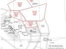
ILS runway 02 approach chart (Graphics: AIP Taiwan):
http://avherald.com/h?article=477bcc95





Komentarze